Bug Fire Containment Doubles as Route 395 Reopens
Rain helped crews as the fire passed 88,000 acres in two states.
6 min read
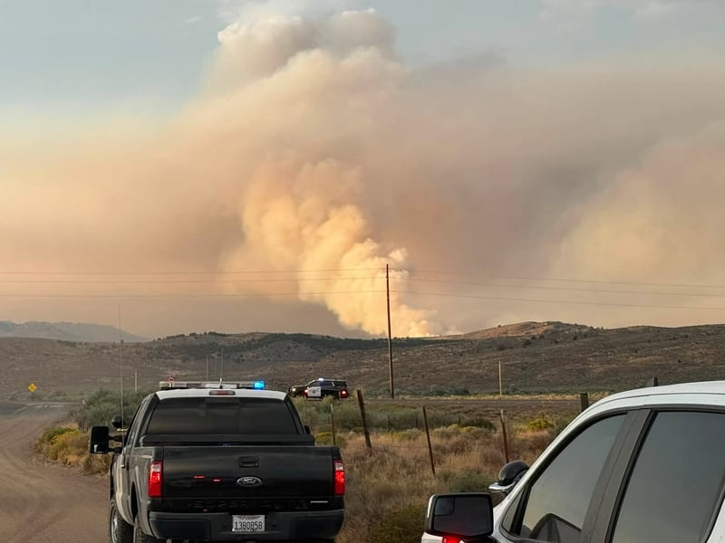
Sierra County deputies assist with Bug Fire evacuation notifications in Lassen County on Wednesday.
Sierra County Sheriff’s Office
HALLELUJAH JUNCTION — Containment of the Bug Fire more than doubled Friday, and United States Route 395 reopened after a closure that began Wednesday evening. It was the second time the fire has closed Route 395 since it started just east of the highway in Lassen County on Saturday, August 8, and burned into Nevada. The Southwest Complex Incident Management Team 1, which took command Tuesday, put the fire at 88,422 acres and 31 percent contained Friday morning, with 591 personnel assigned. On the National Interagency Fire Center’s Friday list of large fires, it was the biggest active wildfire in either California or Nevada.
Rain on Thursday drove the week’s gains. Wetting rains over the fire area let crews attack the fire’s edge directly, protect structures, and secure properties in nearby communities, the incident management team said in its Friday update. Crews made strong progress on the southern flank near Cold Springs, which was fully secured, and on the northern flank in the Petersen Mountains. “Crews secured the northwest flank of the Bug Fire, allowing Highway 395 to reopen, and evacuation orders have been lifted for portions of Red Rock Road and Hungry Valley, allowing those residents to return home,” the update said.
Route 395 first closed on the night the fire started. It shut in both directions near Bordertown on Saturday, according to the Sierra County Sheriff’s Office, and the Nevada Highway Patrol closed the northbound offramps at White Lake Parkway and Village Parkway. The highway was open again by Sunday, when Washoe County reported that all previously closed northbound offramps had reopened. Thunderstorm winds pushed the fire back west toward the highway on Wednesday, according to the incident management team, and the California Highway Patrol closed Route 395 that evening from the Nevada state line to the Constantia area in Lassen County. Caltrans still listed it closed from the state line to Upper Constantia Road in Doyle on Thursday morning, and reported no traffic restrictions on the northern California portion of Route 395 on Friday afternoon.
On the fire’s western side, crews spent Friday working up and down the Route 395 corridor to cool the ground and reduce the chance of further growth, said Ashleigh D’Antonio, operations section chief for the Southwest Complex Incident Management Team 1. Structure groups were working in Rancho Haven, a Washoe County community in the fire area, to make sure the fire was extinguished in and around the community, she said in a Friday morning briefing. Other crews were trying to close out a stretch of fire line on the northwest side of Rancho Haven that was still open. “The weather has been assisting us quite a bit,” D’Antonio said.
Crews gained ground Thursday in the Dogskin Mountains, a Washoe County range northeast of where the fire started, D’Antonio said. Firefighters tied in a burn off Winnemucca Ranch Road, wrapped it around the north side, and connected it to already-burned ground and to lighter fuels in an old burn scar, she said. Crews then began working directly along the top of the fire while bulldozers pushed in from an adjoining division to tie the line back in. D’Antonio said the team was “looking to lock off this piece of ground on this north finger within the next couple of shifts.”
Containment also grew on the fire’s south end, where crews shifted to mopping up and patrolling for hot spots. D’Antonio said infrared scans flown in the evening help identify areas where heat remains, and that crews were working in the Red Rock area to put out any smoke they could still find in the community. Firefighters were also working an uncontained stretch of the fire in a grid pattern to find and extinguish remaining heat, she said, in hopes of having it contained by the end of the shift.
The fire moved quickly from when it started at around 3:30 PM on August 8, about three miles south of Hallelujah Junction. Mapping flights measured 2,467 acres by 6:37 PM and 4,182 acres by 7:11 PM Saturday, when CAL FIRE reported the fire was threatening Cold Springs in Washoe County, Nevada. Another flight put it at 6,529 acres before midnight.
Growth continued for four more days. CAL FIRE listed 11,405 acres Sunday evening, 16,680 acres Monday evening, and 44,304 acres at 6:12 AM Tuesday, minutes after the incident management team assumed command. The Bug Fire’s total now includes acreage from the Fred Mountain Fire, which had been burning separately to the east. The center reported 57,966 acres and no containment Wednesday morning, describing extreme fire behavior with wind-driven runs and spotting, and numerous structures and critical infrastructure threatened. CAL FIRE listed 88,442 acres and 15 percent containment Thursday morning, then 31 percent that evening.
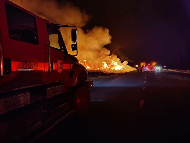
Crews fight the Bug Fire on Thursday night.
CAL FIRE Lassen-Modoc Unit
Evacuation zones came down on both sides of the state line Friday. CAL FIRE posted at 2:04 PM that Lassen County zone LAS-671-B had been downgraded to a warning and that zones LAS-451 and LAS-669-B had returned to normal. Genasys Protect, the official zone map for the California counties, showed three Lassen County zones still active at 3:17 PM: LAS-671-A under an evacuation order, and LAS-671-B and LAS-453 under warnings. Plumas County warnings were downgraded to normal Thursday morning, and orders remain in place in parts of Washoe County, where the Sheriff’s Office and Tribal authorities set the levels.
The Bureau of Land Management’s Carson City District has jurisdiction over the fire. The National Interagency Fire Center listed nine crews, 43 engines, and eight helicopters assigned to the Bug Fire on Friday morning, at a cost of $6.8 million so far, and estimated containment on August 21. The incident management team lists the fire as human-caused.
The same team also commands the nearby Stallion Fire, which stood at 40,698 acres and 44 percent containment Friday, with 322 personnel assigned. D’Antonio said crews there had received precipitation for two days in a row, helping firefighting efforts. The rain also complicated the work: crews on that fire’s south end pulled out because “the road systems and trail systems got too messy from the rain,” she said, and moved to the west side to build line directly along the fire’s edge. The Bureau of Land Management has closed public lands within 10 miles of Moon Rocks, in the North Reno Recreation Area, to entry and camping.
Thunderstorms are forecast again Friday, with cooler temperatures and higher humidity moderating fire behavior. “Gusty and erratic thunderstorm outflow winds up to 40 mph remain possible and can push fire in new directions with little warning,” the incident management team said, adding that a warming and drying trend is forecast in the coming days. California zone status is posted on Genasys Protect and Washoe County status on Perimeter. The Bug Fire information line is 775-800-7244, staffed from 8 AM to 8 PM.