Clover Fire Forces Evacuations in Nevada County’s Alta Sierra
Cal Fire reported 12 acres and no containment Friday afternoon.
2 min read
Updated
Update: All evacuation orders and warnings for the Clover Fire have now been lifted.
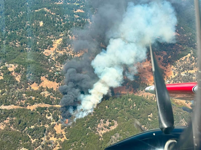
A photograph of the Clover Fire taken from a CAL FIRE aircraft.
CAL FIRE NEU
ALTA SIERRA — A wildfire burning Friday afternoon in the Alta Sierra area south of Grass Valley grew to 12 acres within an hour of its start and pushed residents of one Nevada County evacuation zone out of their homes. The Clover Fire began at 1:47 PM in the 15000 block of Clover Valley Road, according to CAL FIRE, whose Nevada-Yuba-Placer Unit has jurisdiction. The agency put the fire at 12 acres at 2:44 PM and had not posted a containment figure as of its 2:59 PM update.
Nevada County Consolidated Fire District said it and several other agencies were sent to Clover Valley Road and Fay Drive in Alta Sierra for a well-involved structure fire that spread into wildland. CAL FIRE lists the cause as under investigation and has not released a damage assessment. In its first public update, at 1:48 PM, the agency described a fire of 8 acres “with a fast rate of spread” and said structures were threatened.
The Nevada County Sheriff’s Office issued an evacuation order for zone NCO-E048 at 1:45 PM. Zone NCO-E050, which the Sheriff’s Office initially included in the order, was reduced to an evacuation warning at 1:53 PM.
Alta Sierra Elementary School was evacuated, and children from the school were taken to Magnolia Intermediate School at 22431 Kingston Lane in Grass Valley. The county opened a temporary evacuation point in the gym there and set up reunification for the school’s students in rooms A5 and A6. Large and small animals can be taken to the Nevada County Horseman at 10600 Bubbling Wells Road in Grass Valley.
Hard closures were in place at Rainbow Road and Carrie Drive and at Clover Valley Road and Brewer Road, according to the county and CAL FIRE. The California Highway Patrol’s Grass Valley office asked drivers to use caution and avoid the area. Caltrans reported no traffic restrictions on nearby State Route 49, State Route 20, or State Route 174 as of 3 PM.
Power outages were being reported in the area of the fire, according to the county, which directed residents to Pacific Gas and Electric’s outage map. The county asks residents to look up their zone status on the Genasys Protect map linked from ReadyNevadaCounty.org and operates a 24-hour information line reachable by dialing 211.