Plumas Supes Hold Hearing on Fire Hazard Severity Zone Ordinance
June 5, 2025
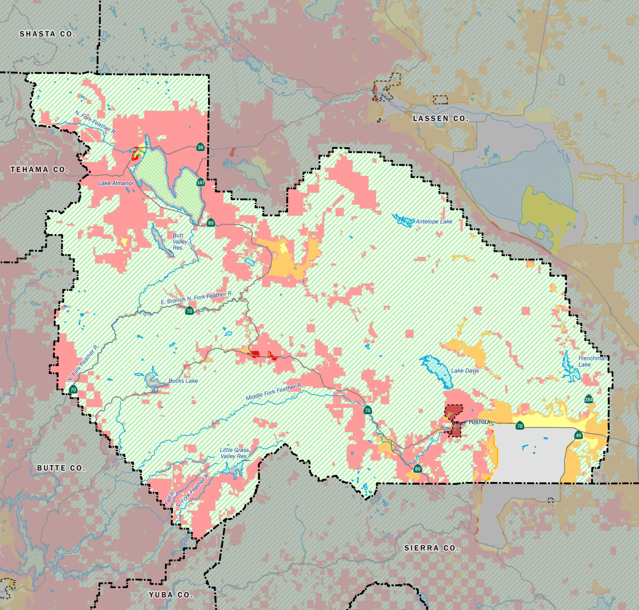
Plumas County’s fire hazard severity map. Areas in red are designated as very high fire risk.
QUINCY — The June 3 meeting of the Plumas County Board of Supervisors gave the public an opportunity to comment on a draft ordinance that will incorporate wildfire hazard severity zone maps that were presented in March into the county code. The maps were developed by the State Fire Marshall as a result of a 2021 state law, SB 63, and extend wildfire hazard classifications to Local Responsibility Areas (LRAs), where local agencies are responsible for wildfire protection.
The draft ordinance, based on a template provided by the State Fire Marshall’s office, pertains to LRAs in unincorporated areas of the county, including Sierra Valley and the towns of Quincy, East Quincy, and Chester. According to the state-developed maps, 99% of Quincy and East Quincy, 77% of Chester, and the northwest edges of Sierra Valley are classified as at high or very high risk for wildfire. The City of Portola is also an LRA but, as an incorporated city, has a separate planning process from the rest of Plumas County.
Hearings on the new fire hazard zone maps are mandated by SB 63 but are effectively informational only. The law does not allow local jurisdictions to change the maps in any way other than to request a higher-risk classification.
Members of the public who spoke at the June 3 hearing expressed concerns about the potential for insurance rates to increase as a result of higher hazard classifications and the inability to modify the classifications based on local knowledge. Board Members Jeff Engel and Mimi Hall expressed similar concerns.
Several speakers argued that factors like defensible space, home hardening, and being in a Firewise community should be considered when setting insurance rates. Representatives of Cal Fire’s Lassen-Modoc unit said they understood those concerns but that the state wildfire maps are intended to express the concept of wildfire hazard—the inherent likelihood that a fire could occur in an area—rather than risk to property. They said that state rules require insurance rates to be based on risk to individual properties rather than area hazard maps and should account for property- and community-level risk-reduction efforts. Supervisor Engel said, however, that “if you think insurance companies aren’t looking at these maps, you’re kidding yourself.”
Chief Eric Ewing of Cal Fire’s Lassen-Modoc Unit explained that local Cal Fire units are able to provide input into the hazard classifications for State Responsibility Areas where Cal Fire, rather than local districts, is responsible for fighting wildfire. He called the lack of a similar mechanism for local input a flaw in the legislation and encouraged people to take their concerns to legislators, the Insurance Commissioner, and Cal Fire.
Board members voted unanimously to continue the hearing and take a final vote on the ordinance at their June 10 meeting. They will also submit a letter with the adopted ordinance conveying concerns about the lack of public input into the hazard classifications and their potential impact on the cost of insurance.
Featured Articles

30-Inch King Salmon Caught in North Yuba Near Downieville →
October 7, 2025
Young angler’s birthday catch highlights salmon reintroduction efforts in North Yuba River.
Governor Newsom Vetoes Firefighter Pay Raise Bill →
October 13, 2025
Plumas Supervisors Decide Not to Act on Resolution Opposing Prop. 50 →
October 8, 2025
Alliance For Workforce Development Highlights Sierra County Services →
October 8, 2025
California Voters to Decide on Prop 50 Starting October 6 →
September 30, 2025