Storms Bring Heavy Rainfall and Local Disruptions
Sierra County faces power outages and water issues amid heavy rainfall and storm warnings.
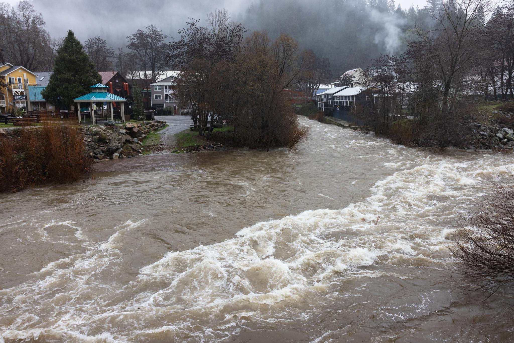
The Downie/Yuba River Confluence at around 10 AM Monday morning.
SIERRA COUNTY — A strong atmospheric river storm system has brought significant impacts to Sierra County over the past week, delivering heavy rainfall across the region. Precipitation began earlier in the week, but the heaviest rain occurred over the weekend, with Sunday, December 21, seeing particularly heavy downpours. Some locations in the Sierra Nevada have already received 10 to 20 inches of rain over the past several days, according to forecasts from the Weather Prediction Center.
Local disruptions accompanied the intense rainfall. Around 3 PM on Sunday, a downed tree damaged a power line, causing an outage in western Sierra County affecting more than 1,200 customers. Town generators in Sierra City and Downieville were activated around 9:30 AM on Monday, December 22, restoring power to those areas.
Water supply challenges have also emerged during the storm. The Downieville Public Utility District halted pumping operations on Sunday because high water turbulence stirred up sediment at its pump location. On Monday morning, the Sierra County Sheriff’s Office issued a notice warning that water levels in Downieville’s holding tanks had reached critically low levels. Water service was restored after power came back on later in the morning, but a boil water notice will now be in effect in Downieville for 7 to 10 days, according to the Sheriff’s Office.
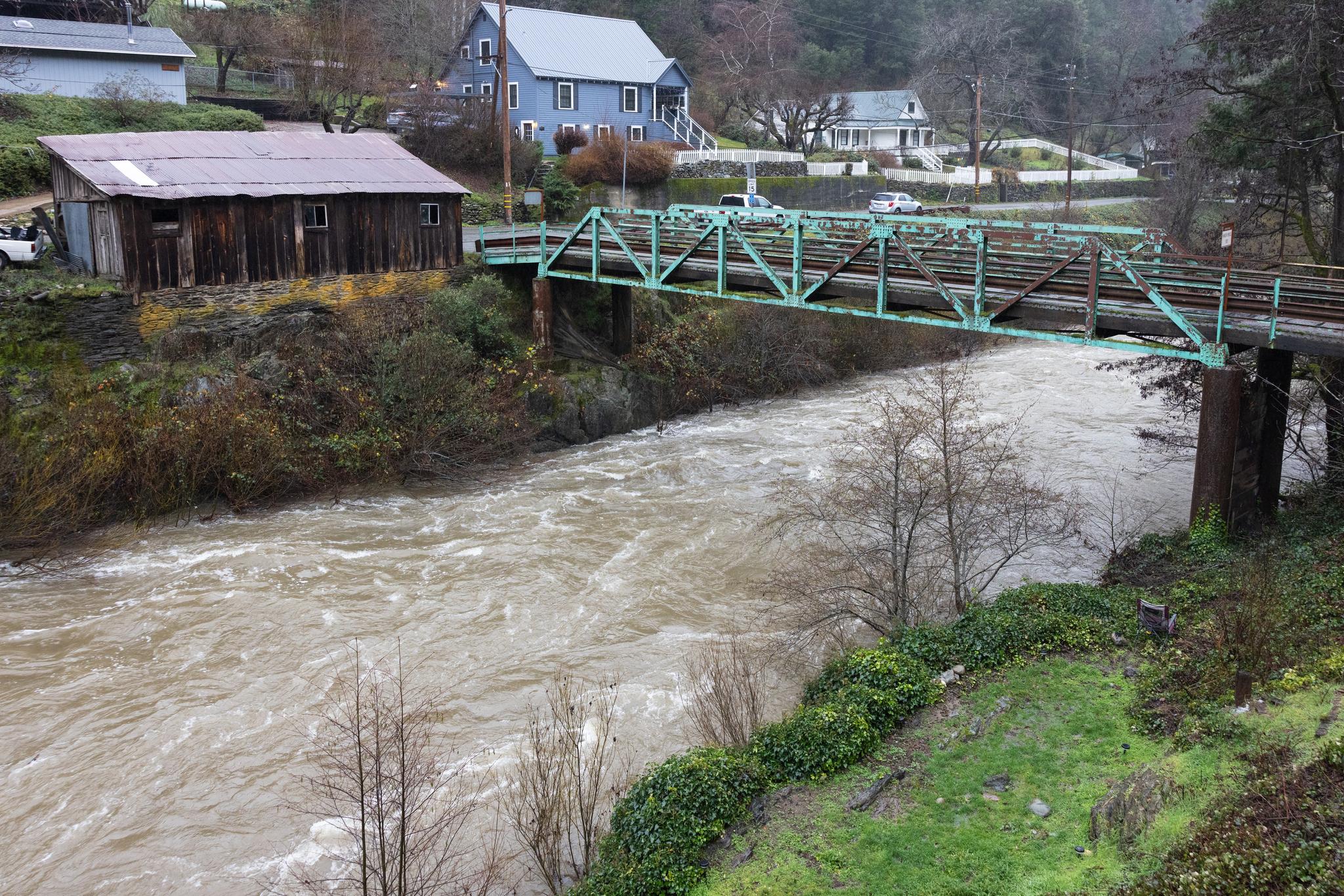
The Downie River under the Hansen Bridge in Downieville at 9:30 AM Monday morning.
The North Yuba River saw a rapid rise in flow during the event. Water discharge peaked at approximately 11,000 cubic feet per second (cfs) early Monday morning, but has since receded to roughly 8,000 cfs at the time of writing, as rain has lightened.
A flood watch remains in effect for western Sierra County and neighboring areas, with additional rainfall raising the ongoing risk of flooding. The National Weather Service has also issued winter storm warnings for higher elevations in the region.
In response, the County issued a notice about the availability of sandbags at multiple locations to help residents protect their property. Sandbags can be obtained at the following sites:
Loyalton, at the County Road Shop, Garbage Pit Road (Loyalton Dump), is stocked and open until 4:00 PM on work days.
Sierraville, at the County Road Shop, 104 Battelle Road, is stocked and open 24/7.
Temperatures have remained relatively mild so far, keeping snow levels high at 8,000 to 10,000 feet or above through Tuesday and into early Wednesday. Most precipitation has fallen as rain, even at higher elevations. A strong cold front is expected to arrive mid-week, however, lowering snow levels. The National Weather Service has now issued a Winter Storm Warning stating that accumulations of up to a foot are expected between 4,500 and 5,500 feet, with 4 to 8 feet or more above 5,500 feet in the Sierra County area between 10 PM Tuesday and 10 PM Friday.
Road conditions over the weekend were hazardous, with standing water, downed vegetation, and debris making driving difficult. No chain controls are currently required on Highway 49 within Sierra County. Controls are likely to be implemented later in the week over Yuba Pass and other high-elevation routes as snow begins to accumulate.
Residents are encouraged to monitor updates from the National Weather Service, the Sierra County Sheriff’s Office, and local authorities for the latest developments.