Snow Blankets Downieville, Winter Storm Rages
Spinouts forced westbound I-80 traffic to turn around at Truckee, and chain controls extended across Yuba Pass.
3 min read
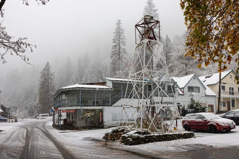
The Downieville bell tower covered in snow on Wednesday morning.
Staff Photo
DOWNIEVILLE – Downieville saw its first snow of the season Wednesday, November 18. By 11:30 AM, more than an inch had fallen in town. Farther up Highway 49, snow was falling again at Bassetts and over Yuba Pass.
At 11:25 AM, Caltrans had chain controls on Highway 49 from seven miles north of Downieville through Sierra City and over Yuba Pass to Sattley. Chains or traction devices were required except on four-wheel-drive and all-wheel-drive vehicles with snow tires on all four wheels. Those drivers still had to carry chains.
On Interstate 80, several big rigs without chains could not make the grade near the Highway 20 interchange shortly after 9 AM, according to the California Highway Patrol’s dispatch log. After multiple spinouts, Caltrans turned westbound drivers around at Truckee while crews cleared trucks from the highway. CHP reported at 11:26 AM that officers were escorting graders and traffic through the area. Caltrans still listed the westbound hold at Truckee at 11:29 AM.
Image 1 of 2
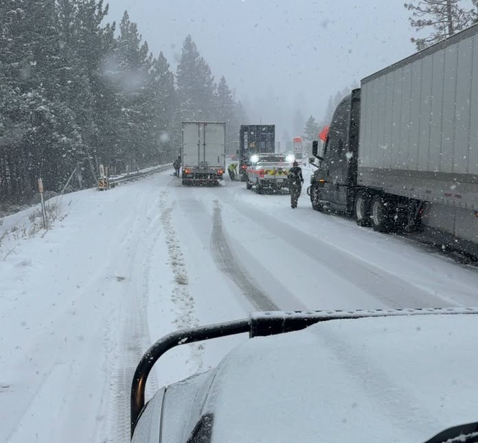
A crew works among trucks on snow-covered Interstate 80 Wednesday morning.
Caltrans District 3
Eastbound I-80 drivers faced chain controls from 3.4 miles east of Gold Run to Truckee, and crews screened eastbound trucks at Applegate. On Highway 20, chain controls began six miles east of Nevada City and continued to I-80. At 10:53 AM, CHP also reported that gates on Donner Pass Road, also known as Old Highway 40, were closed at Donner Lake and the ski ranch.
Near Bassetts, a sensor at San Francisco State University’s Sierra Nevada Field Campus recorded an increase in snow depth from four inches at 7:45 AM to six inches at 9:45 AM. At the Independence Lake station, elevation 8,340 feet, the snow on the ground deepened from 19 inches at 9 AM to 22 inches at 11 AM.
At Soda Springs, the University of California, Berkeley’s Central Sierra Snow Lab measured two-tenths of an inch of new snow in the 24 hours ending at 8 AM Wednesday, bringing its seven-day snowfall to 28.7 inches. Much of that came in the previous storm, which brought snow to Gold Lake Highway and repeatedly stopped traffic on Donner Summit Friday.
The National Weather Service’s 11:13 AM winter storm warning calls for storm totals of six to 15 inches between 4,000 and 5,000 feet on the northern Sierra’s western slopes. Forecasters expect two to four feet above 5,000 feet and as much as five feet on the highest peaks by 4 AM Friday, November 20. Light accumulations are possible as low as 3,000 feet.
The Downieville-area forecast calls for rain Wednesday afternoon and overnight. Rain and snow showers are possible early Thursday, with little accumulation expected.
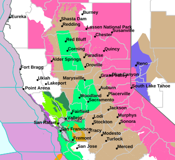
Pink marks the Sierra winter storm warning on the National Weather Service’s 11:20 AM Wednesday map. The warning extends through 4 AM Friday.
National Weather Service Sacramento
On the east side, the National Weather Service in Reno forecasts six to 12 inches above 5,500 feet in eastern Sierra and Plumas counties, with up to two feet in some areas west of Highway 395. Drivers can check Caltrans QuickMap for current chain controls and traffic holds.