Bear Fire Spreads Near Loyalton
September 2, 2024
Updated September 6, 2024 at 4:00 PM
9/6/2024, 9:00 AM — Containment is now 15%. The fire has grown little over the last 24 hours, and is now measured at 3,327 acres per Cal Fire. According to Tahoe National Forest, existing lines will be strengthened and new ones scouted today. Hazardous burned trees will also be removed, and crews will be working on extinguishing hot spots near control lines. Wind and temperature are expected to increase through the weekend, and there will be a slight chance of thunderstorms later today. Sierra Brooks is no longer under an evacuation order and is beginning to repopulate, but an evacuation warning remains in effect.
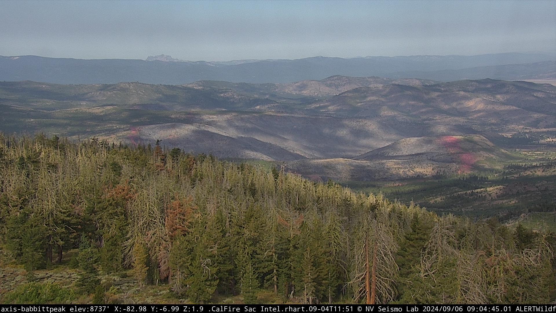
Camera on Babbitt Peak shows no signs of fire activity on Friday, September 6th, at 9:04 AM. Image from ALERTCalifornia.
9/4/2024, 9:12 AM — The fire is estimated to be 3,000 acres and continues to show signs of activity. Today, firefighters will be working to construct a direct containment line using dozers and hand crews, according to the Tahoe National Forest. Southeast winds are expected with gusts up to 10 mph, with a shift eastward in the evening.
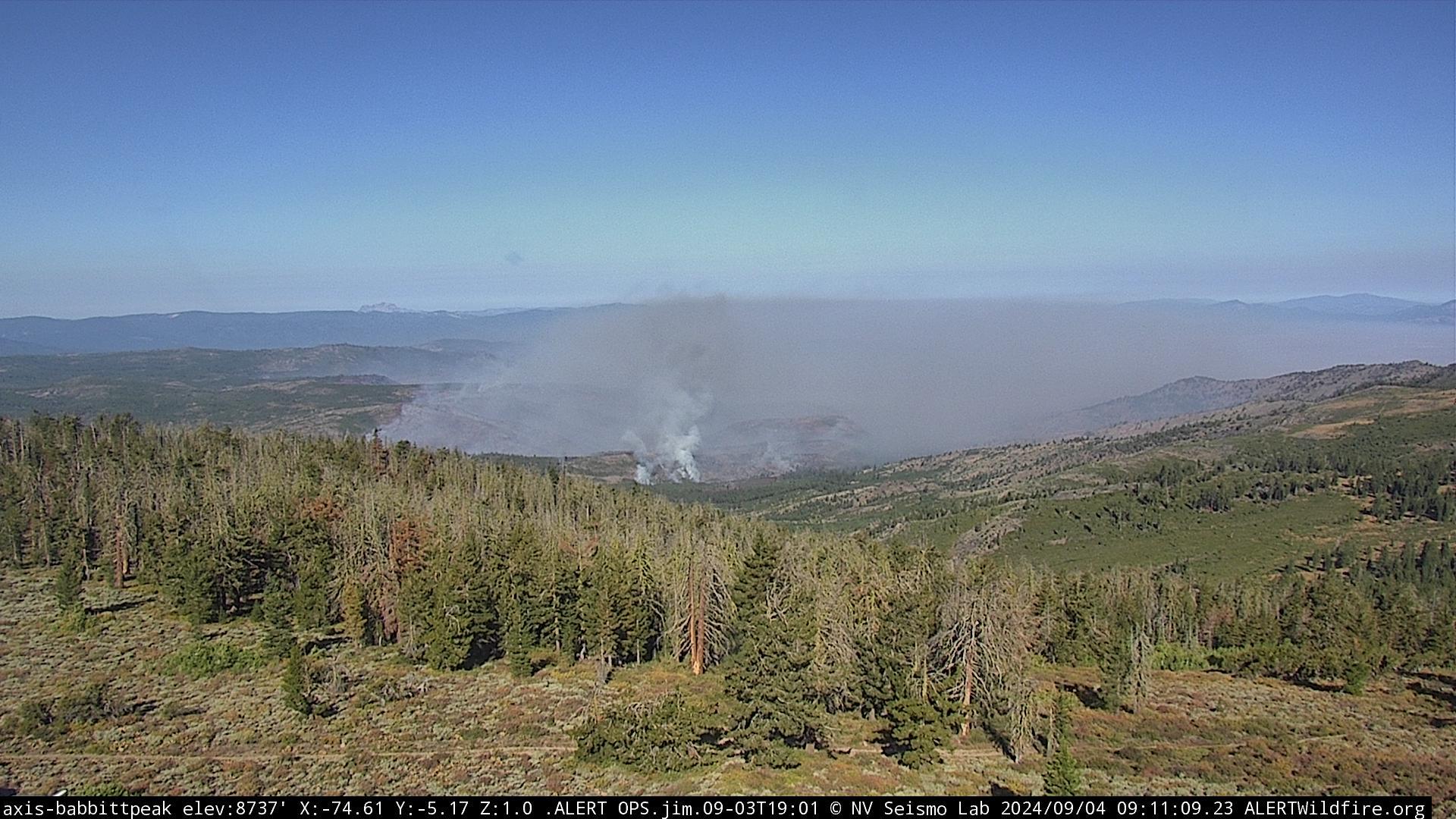
View of the Bear Fire from Babbitt Peak on Wednesday, September 4th, at 9:11 AM. Image from ALERTCalifornia.
9/3/2024, 6:54 PM — Fire activity remains high, with increased burning near Smithneck Road towards the northeast perimeter. The most recent mapping indicates 2,000 acres burned.
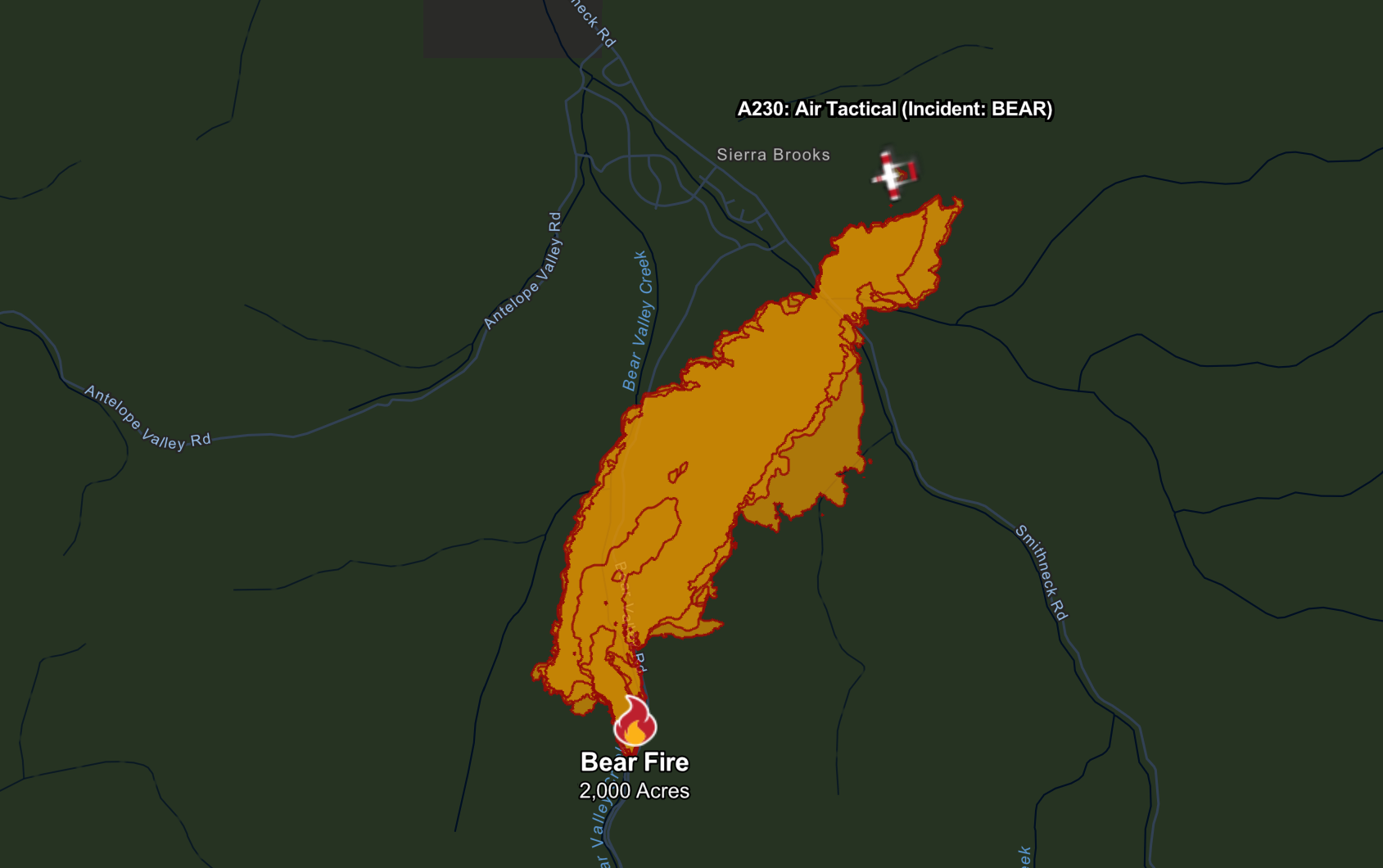
Bear Fire perimeter on Tuesday at 6:53 PM. Map provided by Cal Fire.
9/3/2024, 4:44 PM — Evacuation orders have been issued for Sierra County zones SIE-E058 and SIE-059. See below map for details.
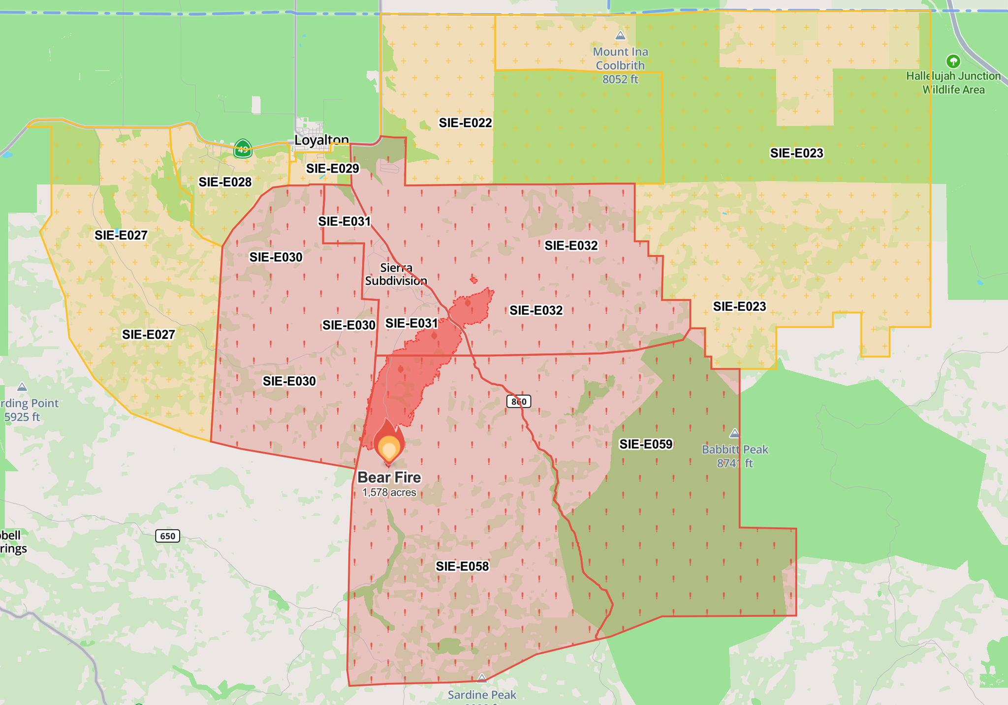
Bear Fire spread and evacuation zones as of Tuesday, 4:44 PM. Image from Watch Duty incident map.
9/3/2024, 4:00 PM — The Bear fire has been measured at 1,578 acres according to Cal Fire. Activity remains high, but burning seems most concentrated on the southern front, away from Sierra Brooks.
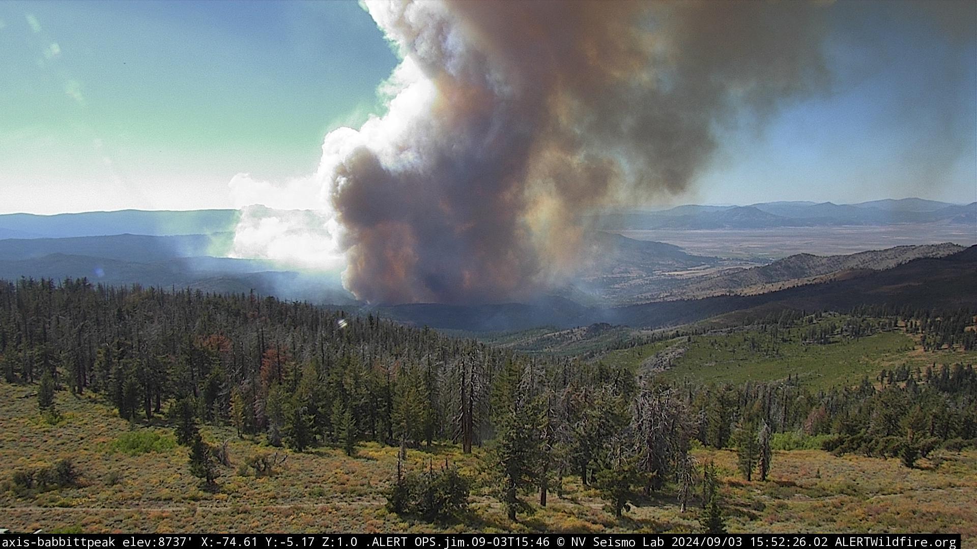
View of the Bear Fire from Babbitt Peak at 3:52 PM. Image from ALERTCalifornia.
9/3/2024, 1:45 PM — Fire activity has increased over the last hour after a relatively stagnant morning. Wind speeds have increased dramatically. No new official information has been released since 9:00 AM.
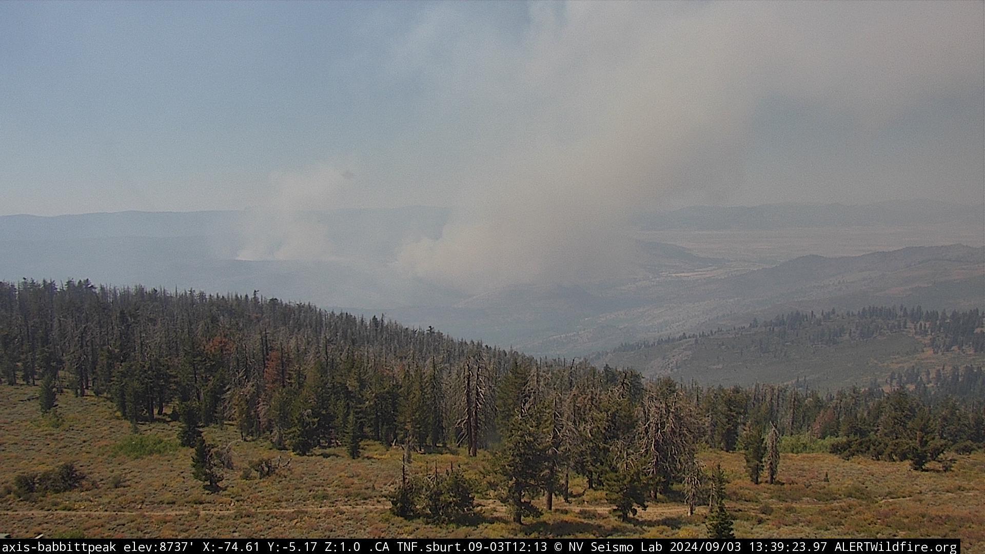
View of the Bear Fire from Babbitt Peak at 1:39 PM. Image from ALERTCalifornia.
9/3/2024, 9:14 AM — According to the Tahoe National Forest, the fire is now 1,391 acres, but activity slowed overnight due to cooler temperatures and lower winds. Crews are working to establish fire lines, with heavy emphasis on protecting Sierra Brooks. 286 structures and 536 residences have been evacuated, and 760 residences are without power. The cause of the fire remains under investigation.
9/2/2024, 7:38 PM — Cal Fire mapping places the Bear Fire at 1,183.3 acres burned. Air tankers continue to respond into the evening.
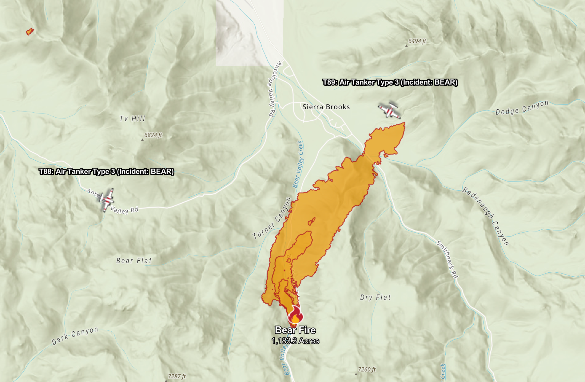
Burned area mapped by Cal Fire.
9/2/2024, 6:37 PM — Sierra County has issued evacuation orders for zones SIE-E032 and SIE-E030 to the east and west of Sierra Brooks. Additionally, evacuation warnings have been posted for several surrounding zones.
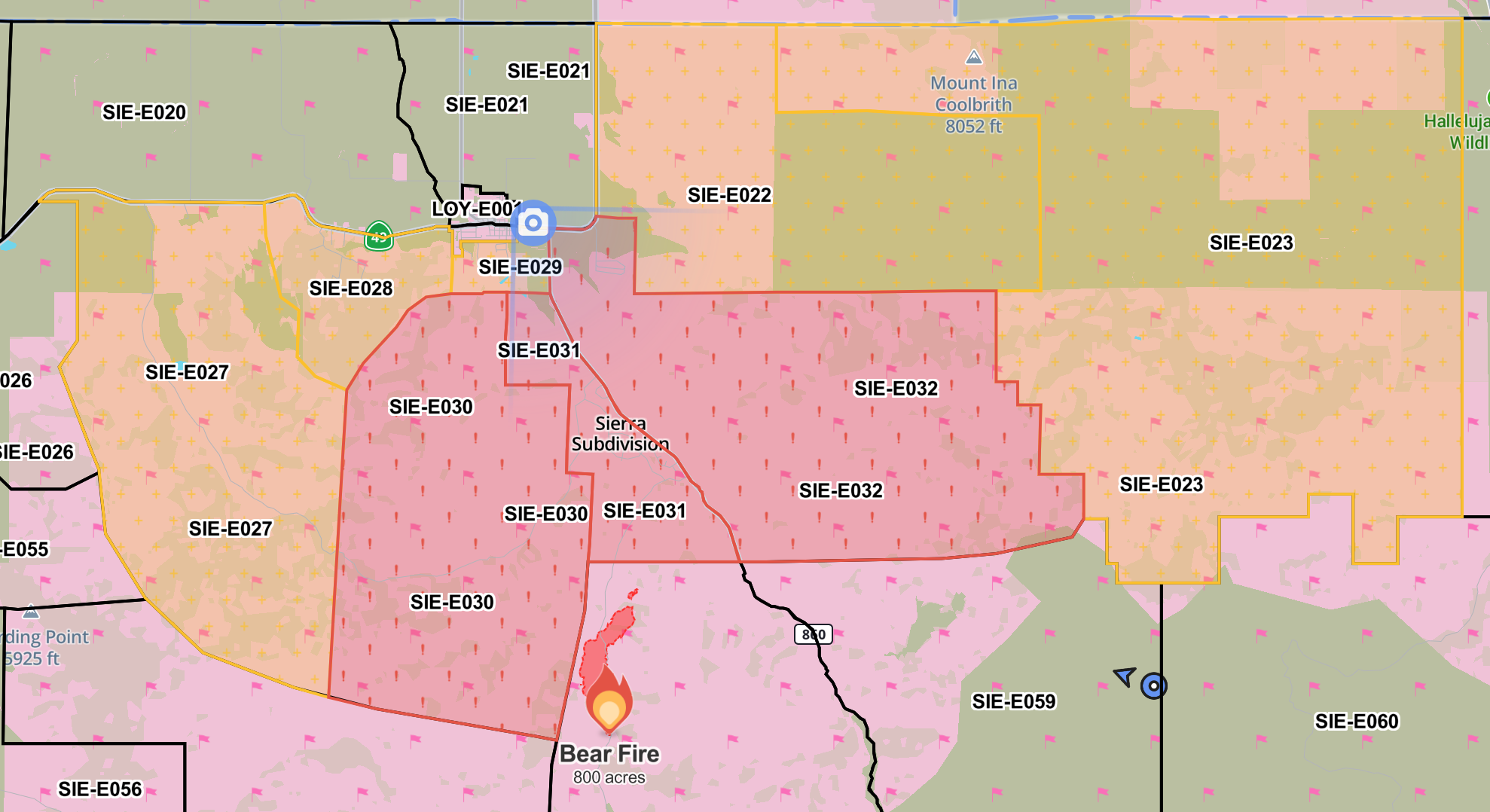
Current fire spread and evacuation orders and warnings as shown on the Watch Duty incident map.
9/2/2024, 6:06 PM — Tahoe National Forest is reporting that the Bear Fire has ballooned to over 800 acres according to resources on scene.
9/2/2024, 5:08 PM — The fire is now mapped at 196.56 acres by FIRIS, and is rapidly approaching Sierra Brooks. According to the Tahoe National Forest, resources on scene are reporting 200 - 250 acres. Evacuation orders remain in effect for zone SIE-E031, with county-wide cell phone emergency alerts having been issued.
9/2/2024, 4:28 PM — The Fire Integrated Real-Time Intelligence System (FIRIS) Program has mapped the Bear Fire at 63.94 acres. Air attack is ongoing.
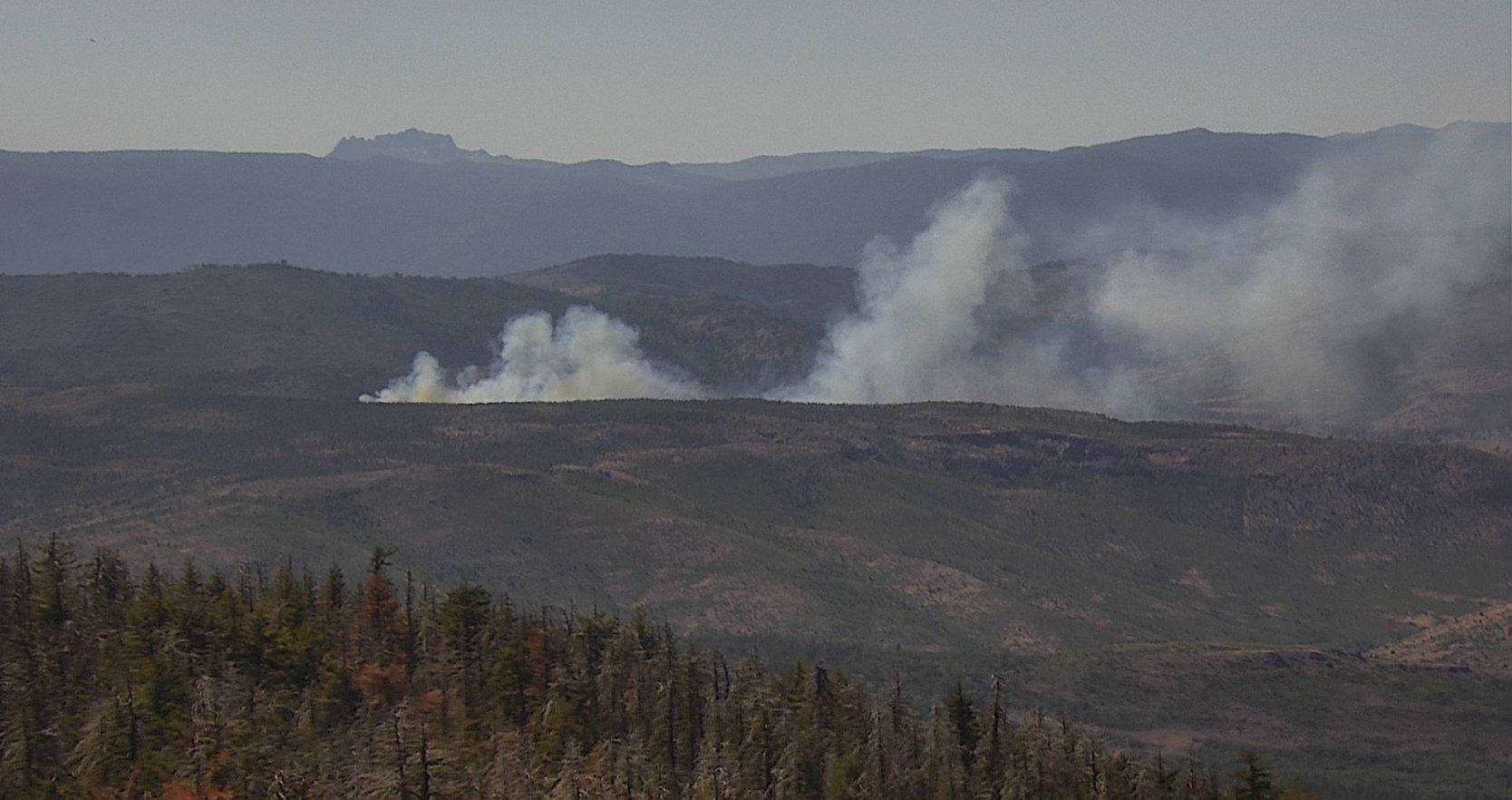
An image of the Bear Fire provided by the US Forest Service.
LOYALTON — As reported by the Tahoe National Forest, the Bear Fire has ignited between Loyalton and Stampede Reservoir. Approximately 40-50 acres has burned, and the fire continues to spread at a high rate.
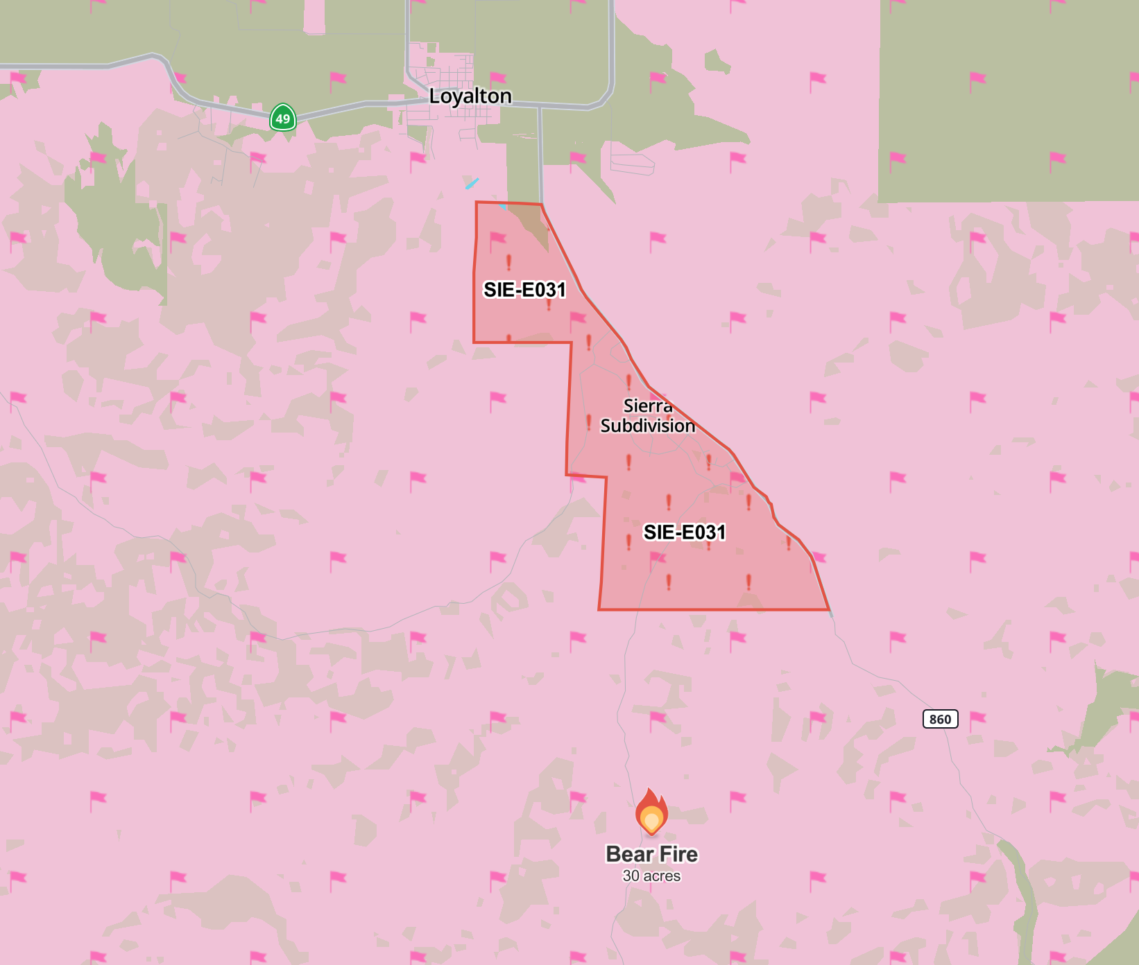
The location of the Bear Fire in relation to Loyalton, including zone currently under evacuation order. Image from the Watch Duty incident map.
An evacuation order has been issued for zone SIE-E031 south of Loyalton, as pictured above. Further zone evacuations will be shown on the Genasys Map. The Sierra County Sheriff’s Office also recommends residents sign up for the Everbridge Emergency Alert Program.
The Tahoe National Forest continues to be under Enhanced Fire Restrictions, and Red Flag Warnings, signaling increased fire danger, have been issued for the region. Temperatures have been high and humidity low, and strong winds are greatly increasing the risk of fire spread.
This article will be updated as more information about the Bear Fire becomes available. The non-profit organization Watch Duty also provides regular updates.
Featured Articles

Sierra County Supervisor Lila Heuer Won’t Seek Reelection →
February 3, 2026
Heuer cites health and family priorities as she plans to complete her current term only.
Sierra County Honors Retired Road Maintenance Supervisor Edward Cusato →
February 4, 2026
Transfer Site Burns Discussed, Sierra City Monitoring Upgrades Approved →
February 5, 2026
Assembly Committee Probes Predator Conflicts in Rural California →
January 28, 2026
“Move In!” Program Launches with Private Sector Support →
February 6, 2026