FEMA Unveils Expanded Floodplain Maps for Sierra Valley
FEMA’s new maps could require more Sierra Valley homeowners to purchase flood insurance.
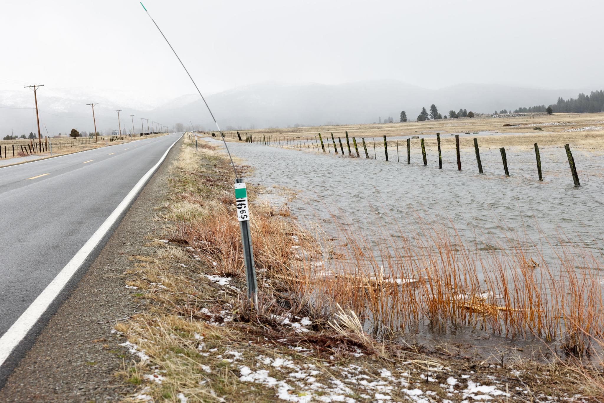
Flooding is common near Sierraville, where water nearly reached Highway 49 earlier this year.
SIERRA COUNTY — The Federal Emergency Management Agency (FEMA) is responsible for creating maps of areas in which flooding has a 1% chance of occurring per year (colloquially known as a 100-year flood event). A significant function of the maps is determining which properties need to be covered by flood insurance when taking out federally backed mortgage loans. Government construction or substantial improvements within mapped floodplains are also required to be adequately flood-proofed.
Since around 2010, eastern Sierra County has been undergoing an extensive process to update and digitize floodplain maps in the Sierra Valley, according to Sierra County Planning Director Brandon Pangman. FEMA created new maps based on available data around 2012, but to the dismay of eastern residents, it significantly expanded the floodplain area in Loyalton, and concerns were raised about accuracy.
While updated flood maps in western Sierra County have been adopted, a back-and-forth process has continued in the Sierra Valley involving several consultants. The valley was re-studied around 2018, which resulted in maps with an even more extensive floodplain. Then, the valley was overflown using Light Detection and Ranging in another study, through which new maps were produced in 2023. After community meetings for the maps, Pangman says “everybody was really upset.” Following the feedback, Sierra County and the City of Loyalton were able to find the money to ask engineers to evaluate the maps and provide technical comments, after which FEMA agreed further study was necessary.
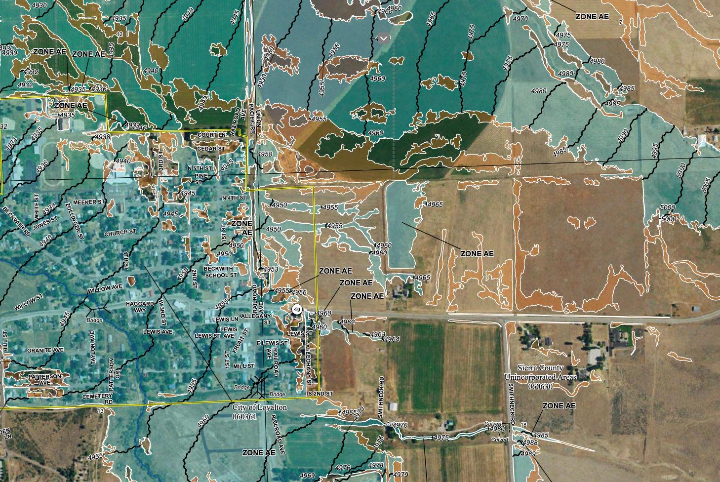
New maps encompass almost all of Loyalton in the 1% chance-per-year floodplain (colored blue).
Over the last two years, FEMA has conducted a third study, the results of which are now available in new floodplain maps. The maps still expand the previously mapped footprint of the floodplain to encompass almost the entirety of Loyalton. If they become effective, the maps would significantly increase the number of homeowners in the Sierra Valley who need to purchase flood insurance.
A lengthy adoption process awaits the new maps before they take effect. Introduced at the Sierra County Board of Supervisors meeting in Downieville, the maps will be presented to Sierra Valley communities through several community meetings, where the public will have the opportunity to provide comments. Pangman and supervisors are working to schedule meetings, including potentially in collaboration with the City of Loyalton. The item will also likely be brought back to the next board meeting in Loyalton on Tuesday, November 18.